Fire did not increase ninefold. The satellite changed.
MODIS records 1 km pixels; VIIRS records 375 m pixels. Adding their detections directly creates a jump when the instrument changes.
×9.5
apparent increase from merging the records directly
×1.8
activity ratio after harmonization into one comparable unit
The same Patagonian record, processed two ways. These are ratios of recorded thermal activity, not counts of unique fires or burned area. Harmonization removes a large instrument-driven discontinuity; it does not show that fire activity stayed constant.
The proof
Calibrated in the north, tested in Patagonia: 2.1% off.
The 2.1% is the difference in the whole test total. Typical monthly error was ×1.37 on months with at least five Aqua detections. The app also maps where regional conversion fails.
Retrospective evaluation: static-source preprocessing uses the full archive. Production factors were refitted after testing. The aggregate result is not a guarantee for each month or selected area.
NOAA-20 and NOAA-21 extend the record after S-NPP data stopped arriving in our FIRMS feed in early November 2026. Spacecraft status is not inferred from this feed gap.
Why it matters here
Patagonia’s fire record includes industrial heat
≈37%
of Patagonian VIIRS detections are classified as static or industrial by the filter.
Around Vaca Muerta, persistent heat can be confused with vegetation fire. Product flags, recurrence and industrial cells help separate the signals.
36.6% before filtering; 15.3% from product flags alone. Classification is not a confirmed inventory of gas flares. The filter can also exclude vegetation fire in industrial cells.
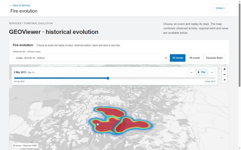
Cholila · Chubut · Observations replayed on 3D terrain Smooth heat shows detection density, not a burned perimeter or a spread forecast.
The discovery in the record
The yardstick moved
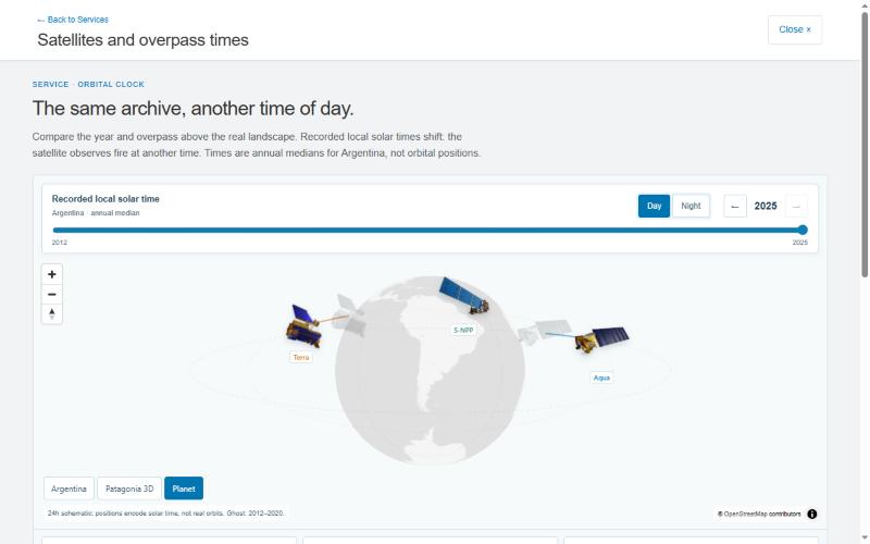
In 2025, Terra’s recorded daytime median was 69 minutes earlier and Aqua’s 68 minutes later than in 2012–2020.
The detection ratios against S-NPP changed too:
−35%
Terra · day
+28%
Terra · night
−31%
Aqua · night
A change in the observation system can look like a change on the ground. The orbital drift is known; this project measured its timing and sensor-specific differences in the Argentine record.
The satellite clock · recorded local solar time, year by year NASA technical spacecraft renders; positions are explanatory.
Observed ratios are not changes in fire activity and do not isolate the causal effect of timing. Sensitivity, geometry and processing also matter. The project retained these three changes and rejected daytime Aqua as a robust effect.
Why trust the method
13 laws survived. 22 did not.
13
findings passed the project’s validation criteria
22
candidate laws tested and discarded
Write the claim and what would refute it before running the test.
Test on withheld years or regions, with shuffled-data controls where applicable.
Keep the failures visible. The app shows rejected ideas and regional limits.
The findings register retains 25 entries: 13 validated, 4 fragile, 2 hints, 2 operating rules and 4 descriptive results. “Validated” refers to the project’s stated tests; it is not a claim of universal laws.
For a brigadista comparing this week with 23 fire seasons
“Is this week unusual here?”
Fire Memory puts the satellite record in one unit, compares recent activity with history and shows where the conversion can be trusted.
Show the map of where it fails. Regional limits and missing coverage remain visible.
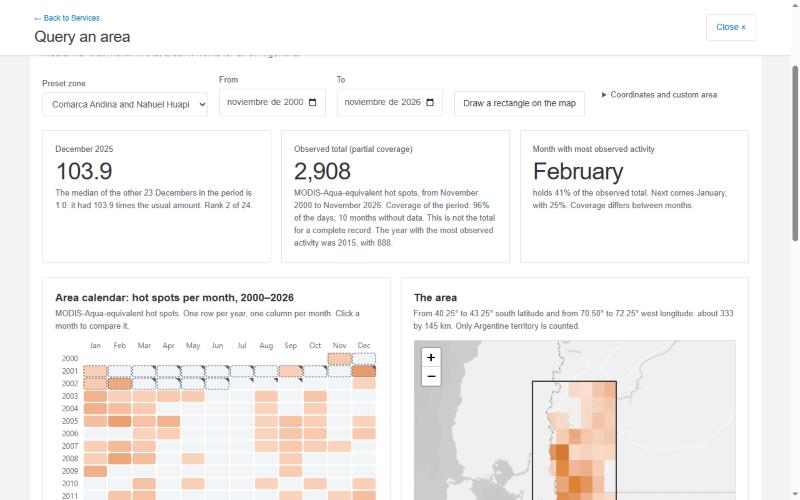
Weekly regional context: 2002/03–2024/25. The area calendar compares complete months with their historical median. Intended monitoring support, not demonstrated improvement in firefighting outcomes.
Draw a Patagonian area → calendar → complete month vs median → download Then open the regional reliability map.
Fire did not multiply ninefold. The satellite changed. Fire Memory corrects the record and shows where you can trust it.
Argentina · Retrospective evaluation · Small fires before 2012 cannot be reconstructed · January–October 2026 is not loaded · Observed heat is not a spread forecast.